Start from the beginning of our motorcycle road trip.
Big Sur. A month ago, neither Ben nor I knew much about it. I had seen occasional mentions on Facebook, using accompanied by fawning superlatives and photos (some beautiful, but many surprisingly mediocre, given the descriptions that accompanied them). When we started planning our trip, south seemed the logical direction to go — we had already explored the coast to the north and we had to avoid the ice and cold of the Sierra Nevadas.
We knew that Carmel and Monterey were obvious destinations in a southward coastal drive, but we had no idea where Big Sur was (I thought it was near San Diego). Wikipedia enlightened us: "Big Sur is a sparsely populated region of the Central Coast of California where the Santa Lucia Mountains rise abruptly from the Pacific Ocean .... the segment of California State Route 1 between San Simeon and Carmel." Perfect.
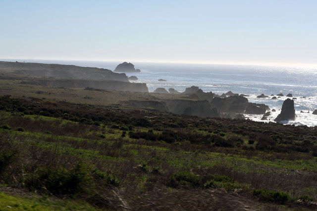
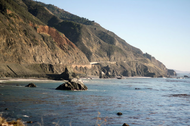
We therefore devoted Day 3 entirely to Big Sur. We started in Monterey and quickly hit the road, since we didn't have to pack up our tent or sleeping bag (and the motel coffee was surprisingly drinkable, not that we would have turned it down if it weren't). The road hugs the coastline (though it wasn't nearly as precipitous as I expected), and most everything is accessible right off the highway. There are plenty of turnouts for enjoying the views (and for slow cars * cough cough * to get out of the way).
(Tip: If you're viewing this in a web browser, you can click on any of the photos to enlarge them. This won't work if you're reading it on email.)
There is also an actual town of Big Sur, which happened to be hosting its annual crafts fair. We admired some wooden bowls and photographs, bypassed the candle and clothing section, and continued on to Pfeiffer Big Sur State Park for lunch.
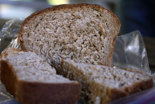
(In case you're wondering, here's the recipe of that delicious-looking loaf of bread, baked by yours truly).
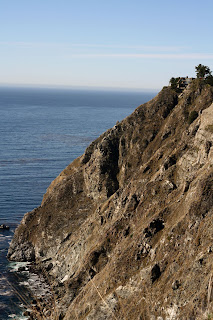
We spent the rest of the day enjoying the drive. Despite dubious weather reports, we barely saw a cloud. In fact, we were so warm in our motorcycle jackets that we tried not to stop for more than two minutes at a time. I don't have much else to say about the drive, other than that it's beautiful, so I'll let you enjoy the photos a bit. (Tip: Click on a photo to see a slideshow.)
 |
| Cows! |
Again we reached our campsite earlier than we expected, so we continued driving. We wanted to see more of the coast and also needed to get gas. We were planning to cross the Santa Lucia mountains the next day and weren't sure when we could next fill up (we get better gas mileage than cars at about 45mpg, but with only a 4.2 gallon tank, we have to fill up a lot more often).
We finally found a gas station in the "town" of Gorda. Check out the price.
We then doubled back to Limekiln State Park, so named for iron kilns that burned and purified lime in the late 1800s, until the limestone deposits were depleted. Today the park sits right on the beach extending to the redwood forests of Los Padres National Forest. We hiked up to see a 100' waterfall along Limekiln Creek.
Given the choice of a campsite on the beach, at the creek or in the redwood grove, we chose the beach (I wanted to hear the waves) only to discover our site had no privacy, very hard ground, and a lot of flies. We relocated to a softer spot by the creek then walked down to the beach to watch the sunset.
- Steph
Keep reading ...


No comments:
Post a Comment
All comments are moderated before publishing. Comments with links (unless directly relevant to the post) will not be approved. No spam, please.