 |
| Thousand Island Lake in the Ansel Adams Wilderness |
We finally hit the trail in California for a backpacking trip. It had been 3.5 years since our last trip in Patagonia, and with Ben starting his new job, we grabbed the chance to get off the grid for a few days. We hiked 22 miles through the Ansel Adams Wilderness, in the Sierra Nevadas south of Yosemite. And the best part — we barely saw a soul.
Note: We took too many beautiful photos to include in a single post. I've included our favorites in the overview below, and then linked to additional photos.
Route
Our 22-mile loop started at Agnew Meadows, just outside of the town of Mammoth Lakes. The first day, we followed the Pacific Crest Trail to Thousand Island Lake, where Ansel Adams took some of his most famous photographs. The next day we picked up the John Muir Trail and meandered past Ruby, Emerald and Garnet lakes before spending the night at Ediza Lake. We finished by following the Shadow Creek Trail back to Agnew Meadows (see a map at the bottom of the post). At the highest point, we stood above 10,000 feet.
Day 1
Agnew Meadows to Thousand Island Lake
Distance: 10 miles
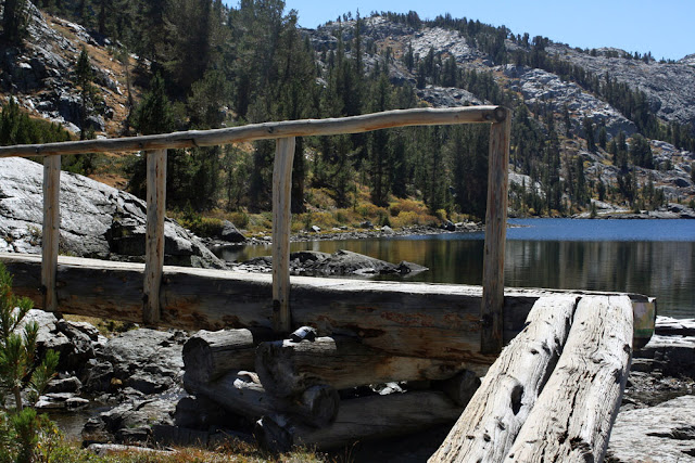
The Pacific Crest Trail runs 2,650 miles from Mexico to Canada. We only hiked a tiny section — about 10 miles from Agnew Meadows to Thousand Island Lakes. As most PCT thru-hikers are farther north by this point in the season, we hardly saw anyone on the trail. The trail rises steeply at the beginning before leveling off and then climbing again to Thousand Island Lakes. It was the most difficult day of our trip, but we managed fine. The views were beautiful all along the way. A nice feature of hiking in California as opposed to New England is that you spend more time above the tree line, which means lots of sweeping views.
See more photos from our hike to Thousand Island Lake
 |
| Me, with Shadow Lake in the background |
 |
| Hiking the PCT/High Trail |
 |
| All campfires were prohibited |
 |
| Ben hiking the PCT/High Trail |
We reached Thousand Island Lake by 6 p.m. There are no established campgrounds at the lake, just rules about where you can set up camp — 100 feet from water, 1/4 mile from the trail, and not near the outflow of certain lakes. It can be tricky to find a secluded spot in the summer but we practically had the place to ourselves. We cooked up mac n' cheese for dinner then hopped in the tent to warm up. Even in September, the overnight low was 30 degrees Fahrenheit. We heard some animals sniffing around our tent during the night, and chose to assume they were deer, and not bears (bears are common in the Sierras, and you're required to carry a hard-sided bear canister to store food).
 |
| Looking for a campsite at Thousand Island Lake |
 |
| Thousand Island Lake is named for the many small rocky islands that dot its surface. |
Day 2
Thousand Island Lake to Ediza Lake
Distance: 5.5 miles
We woke up at 6:15 to catch the sunrise, though the sun didn't actually appear for another 45 minutes. It was beautiful watching the morning rays hit Banner Peak, and reflect onto the lake. We had thought we'd go back to bed afterward, but having gone to bed at 9 p.m., we were surprisingly well rested. And though our tent was covered in ice, the temperature rose drastically once the sun came out, and we enjoyed a relaxing morning sitting on the rocks, drinking coffee and admiring our surroundings.
See more photos of sunrise at Thousand Island Lake
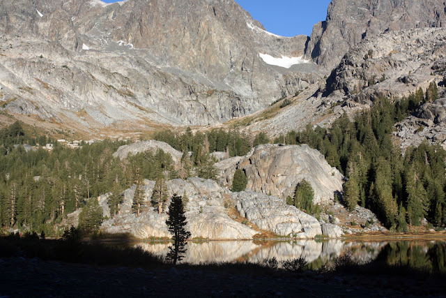
Our hike for the day took us along the John Muir Trail, which runs 215 miles from Yosemite to Mount Whitney. We started with a 500-foot climb over the ridge that separates Thousand Island Lake from Garnet Lake, passing Ruby Lake and Emerald Lake along the way. We ate lunch at Garnet Lake, where the squirrels and bees kept harassing us, and soaked our swollen feet in the lake. After lunch, we struggled through an unexpectedly arduous ascent. Ben kindly took some of the weight from my pack. After reaching the summit, we descended for a while, before linking up with the Shadow Creek Trail for a moderate climb to Ediza Lake. We made it to camp earlier than the previous day, giving us enough daylight to make our go-to camping meal of pasta, sausage, garlic and onion. We claimed a campsite on a ledge overlooking the lake and settled in to sleep.
See more photos from the John Muir Trail and Shadow Creek Trail
 |
| Leaving Thousand Island Lake on Day 2 |
 |
| Banner Peak over Garnet Lake |
 |
| Garnet Lake |
 |
| Hiking the John Muir Trail |
Ediza Lake to Agnew Meadows
Distance: 6 miles
Once again we woke early to see the sun rise, not realizing that because Ediza Lake is ringed by mountains, it wouldn't appear until nearly 9 a.m. Our campsite, which had looked so welcoming in the evening, was pretty frigid without the sun's warming glow.
See a panorama taken from our campsite
See more photos of sunrise at Ediza Lake
Once we hit the trail, we wanted to cover the remaining six miles quickly to avoid driving home in the dark. We made it down with enough time to enjoy an amazing burger and Wild Sierra Farmhouse Ale at Mammoth Brewing Company.
 |
| Sunrise over Ediza Lake |
 |
| Sunrise over Ediza Lake |
Conclusion
Overall, it was a great trip. The scenery was unbeatable and it was peaceful having the trails to ourselves. I spent the whole first day marveling at the surrounding beauty, wondering how it had taken us three years to visit this part of California. Plus, we had planned our trip well — each day was strenuous enough to be rewarding, but not so difficult as to take all the fun out of it.
 |
| Ben wearing his new pack |
Gear
We camp enough that we've acquired all the necessary camping gear, but we were missing a few essential pieces of backpacking equipment. We rented a bear canister and bought a water filter. The most difficult challenge proved to be new backpacks. I had been without a backpack since mine broke in Patagonia. Ben's pack was deteriorating and didn't fit him well. We visited two different REI stores, soliciting advice from several salespeople. A lot of the women's packs put a lot of pressure on my lower back, except the Deuter Act Lite 60+10. After wearing it around the store for an hour, loaded with about 25 pounds of pillows and sandbags, I decided it was the pack for me. Ben coincidentally decided he liked the men's version of the same pack. For him, the biggest appeal was breathability of the back design. Hopefully now that we both have good packs, we'll hit the trail again soon.
Driving
The worst part of the hike was definitely the drive. We had to cross the entire Sierra Nevada mountain range, which was supposed to take 5.5 hours and actually took 7 hours. And getting there involves driving through Sonora Pass, which is easily the most terrifying road I've ever driven (and we drive a lot of winding mountain roads). The funniest part was that after making it through the pass, we were starving. We saw a lot of lights ahead of us, and figured it must be a town. As we got closer, we didn't see any buildings or houses, just a lot of lights. We were debating whether it was worth driving around in search of pizza, when I finally pulled up the "town" on Google Maps. It wasn't a town but the Marine Corps Mountain Warfare Training Center. Needless to say, we did not stop for pizza.
Our route
Note: I wasn't able to add the last leg between Shadow Lake (Point D) and Agnew Meadows (Point A).
- Steph


I'm doing some research for a similar loop thanks for a great post. Wonderful pictures.
ReplyDeleteI am doing a longer route this September. PCT- JMT(Thousand Island)- JMT PCT south junction - Back to Agnew meadows. Excited. :D
DeleteThanks
ReplyDeleteI am looking to the same trip , thanks for sharing your experience !
ReplyDeleteThanks so much for this post! This looks like the same route I'm trying to take this spring. I was wondering about any creek crossings that you encountered and how they were (ex. wading vs bridge, etc). I would like to go in May, and while I don't mind hiking in snow, I'm worried about creek crossings since it will be just me and my dog during this heavy snow/rain year.
ReplyDeleteGlad you liked it. Unfortunately, I don't think we can help much with creek crossings. We went in September after one of the driest winters on record. Going in May after the winter we've had is going to be a completely different story.
DeleteThanks
ReplyDeleteLooking to do this hike. Could you please tell me what back country permits you you got to do it?
ReplyDeleteThank you for this wonderful post and your time!
You're welcome! Here's the info on permits: https://www.fs.usda.gov/main/inyo/passes-permits/recreation
Delete